UN
4 Firs Link
£ 370,000
Description
We don't have a Description for this property.
- Bedrooms
- 3
- Bathrooms
- 0

Leaflet © OpenStreetMap contributors
The heatmap indicates the level of crime in the area. The color of the heatmap indicates the crime severity and recency.
Metrics Year-on-Year
- Average area value
- 514,765.00 £Decreased by 11.32 %
- Average area rental value
- 2,050.00 £/moDecreased by 14.30 %
- Est rental Yield
- 4.78 %Decreased by 3.24 %
- Crime Rate
- 7.00 %Unchanged by 0.00 %
from 580,467.00 £
from 2,392.00 £/mo
from 4.94 %
from 7.00 %
Nearby Schools
| Name | Type | Ofsted | Distance |
|---|---|---|---|
| Woodlands Primary School | Community School | Good | 0.78 KM |
| Formby High School | Academy Converter | 1.11 KM | |
| St Jerome'S Catholic Primary School | Voluntary Aided School | Good | 1.18 KM |
| St Luke'S Church Of England Primary School | Voluntary Controlled School | Good | 1.43 KM |
| Range High School | Academy Converter | Requires improvement | 2.06 KM |
Images
Nearby Streets
| Name | Average Price | Average Sqft | Distance |
|---|---|---|---|
| Foxhill Close | £ 270,000 | 0 | 0.00 KM |
| Mere Road | £ 0 | 0 | 0.00 KM |
| Asparagus Trail | £ 3,200,000 | 0 | 0.00 KM |
| Springfield Close | £ 0 | 0 | 0.00 KM |
| Queens Avenue | £ 525,000 | 0 | 0.00 KM |
Nearby Transport
| Name | NLC | TLC | Distance |
|---|---|---|---|
| Freshfield | 2355 | FRE | 0.74 KM |
| Formby | 2354 | FBY | 1.30 KM |
| Hightown | 2356 | HTO | 4.79 KM |
| Ainsdale | 2350 | ANS | 5.83 KM |
| Hall Road | 2229 | HLR | 7.92 KM |
Nearby Listings
| Address | Price | Type | Score | Distance |
|---|---|---|---|---|
| St Peters Avenue, Formby, Liverpool, L37 | £ 345,000 | BUY | 7 / 10 | 0.19 KM |
| St Peters Avenue, Formby, Liverpool, Merseyside, L37 | £ 290,000 | BUY | Unknown | 0.20 KM |
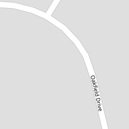
| Oakfield Drive, Formby, Liverpool | £ 395,000 | BUY | 7 / 10 | 0.26 KM |
| Vicarage Road, Formby, Liverpool, L37 | £ 400,000 | BUY | 5 / 10 | 0.29 KM |
| Victoria Road, Formby, Liverpool, L37 | £ 995,000 | BUY | 5 / 10 | 0.30 KM |
Nearby Properties
| Address | Price | Distance |
|---|---|---|
| 6 Firs Link | £ 565,000 | 0.00 KM |
| 1 Firs Link | £ 560,000 | 0.00 KM |
| 4 Firs Link | £ 370,000 | 0.00 KM |
| 4 College Close | £ 250,000 | 0.10 KM |
| 10 St Peters Avenue | £ 264,000 | 0.13 KM |